Fishing Louisiana’s barrier islands

The barrier islands that separate Louisiana’s coastline from the Gulf of Mexico offer some great fishing opportunities, but they aren’t sitting still. Here’s why…
I love everything about Louisiana’s barrier islands: the adventure of getting there, their undeveloped state, the abundance of bird life and waters filled with a variety of fish.

My most-dramatic marine experiences have happened on these islands and strangely, often involved ladyfish and sharks. Occasionally, I have arrived at a barrier island to discover a scene of utter chaos as thousands, maybe tens of thousands, of big ladyfish erupt from the water in undulating waves of fish bodies, while sharks thrash at them.
There is an irresistible temptation to cast a line into these masses of “poor man’s tarpon” and hang on as a 24-inch ladyfish peels drag and performs acrobatic aerial moves until a shark swallows it. This is followed by more peeling drag and the parting of fishing line. I still carry a grudge against the ladyfish that grabbed my dangling lure and stole $250 worth of gear while my back was turned on Isle au Pitre.
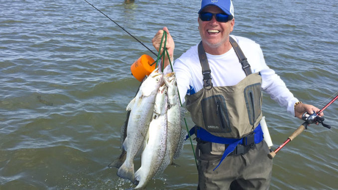
Of course, it is for speckled trout that I travel to the barrier islands, beginning in April and ending in October. My safety protocols prohibit traveling to the distant islands on many summer days due to high winds and frequent thunderstorms, so I cannot fish those islands as often as I would like, but when I can, the fishing experience is rewarding. That doesn’t mean the trout catching is always spectacular, because just like elsewhere inshore, environmental factors control where trout will be found and when they will feed.
Big trout
I believe my chance for catching the biggest of Louisiana’s trout is greatly increased when I fish the barrier islands. As a general rule for the species, the largest trout are caught in the water with this highest salinity, no matter the season. Certainly, exceptions exist — especially in Louisiana with our vast salinity gradient — but I am looking for salinity greater than 15 parts per thousand to improve my odds. The barrier islands are positioned perfectly to provide structure and cover in high-salinity water.
With the exception of Grand Isle, all the barrier islands I have visited communicate a sense of fleeting existence. For instance, Free Mason Island, while being a productive fishing spot, also looks like a giant sand pile delivered to a job site that later went defunct. Recently, that impression of fleeting existence was further strengthened when I learned that a married couple lived on the island from 1957 to 1986. It’s intriguing to think about how they so far from civilization and also sad to realize how much of Free Mason Island must now be missing.

Barrier island formation
A bit of time spent researching the formation of Louisiana’s barrier islands will fill you with awe and paint a mental picture of the cyclical nature of barrier island formation and destruction. The islands have all been formed by the Mississippi River, even the distant Chandeleur Islands, which should trigger a sense of fluidity in our minds.
The Mississippi River has taken various paths to the Gulf of Mexico over the eons, and in fact, it has created seven delta complexes over the past 6,000 years. The river pushes sediment to its delta, where the sediment is deposited. Lighter sediments such as silt and clay create a fan of marshland, but the heavier sand particles take the shortest path to the Gulf of Mexico and fall out at the very end of the river. Here, a dense landmass called a headland is built. To grasp this concept, I think of the solidness of Grand Isle and the Elmer’s Island area, which was part of the Caminada Headland.
Eventually, the buildup of sediment in the delta creates excessive resistance to the river’s flow, which signals the end of a particular lobe of a delta complex, because this resistance causes the river to jump its course somewhere upstream and carve a new and shorter path to the sea. Scientific studies reveal that this major change of course happens roughly every thousand years.
After the river changes course, the abandoned delta will begin a long period of decline defined by land loss. The old delta is starved of new sediment, and the sediment that remains is primarily silt and clay, with a small portion of sand at the barrier islands. All these sediments are loose and easily transported elsewhere by Gulf waters. Erosion and subsidence of the headland will cause it to detach from the marsh, at which point it takes on the identity of barrier islands. Over time, the islands are carried to lower areas and become shoals of sand, so the structure of the delta naturally flattens in a few thousand years, but just like the phoenix, a new delta could be built here precisely because the old delta flattened and thus created a new lower section of coastline, which would draw the river back.
The present river delta
This period of deltaic decline is the prominent event that people living today are experiencing. In the ages before our industrial period, the loss of habitat created by the declining delta was offset by the Mississippi River creating a new delta just a hundred miles away. In this new delta, the communities of biota and animals could flourish and avoid devastation to their populations. But our modern river course is forced to stay within levees, and instead of building a new, major delta, it is forced to empty itself further and further across the inland shelf until now it spits its sediment into the depths of the Gulf, where a delta can never be built.
Some scientists, and possibly the U.S. Army Corps of Engineers, believe that the river would have shifted its course to the Atchafalaya River basin in the 1970s or 1980s if not for the Old River Control Complex. Even now, 30% of the river flow is diverted to create the Atchafalaya River, and a small delta is forming in what was the ancient Salé-Cypremort delta complex, which dates back 5,000 years. A new headland will eventually appear on this new delta, but long after I depart this life.
Land is being built in a small area around the current mouth of the Mississippi River, called the Birdfoot Delta. Some of the land growth is coming via sediment dredged from the river for navigation purposes. The Birdfoot Delta looks unnatural because it’s not connected to the coastline, except for thin slivers of land on either side of the levees, and it looks backwards compared to deltas that are formed naturally. It is clearly creating something unprecedented in the history of the Mississippi River. The mid-Barataria and mid-Breton sediment diversions proposed in the CPRA Master Plan are designed to expand the marsh on either side of the levee, which would make the Birdfoot Delta appear more natural. However, it’s not clear that a headland will ever be built, and therefore, Louisiana will never see another barrier island formed by the river.
Barrier island restoration
I can’t help but cringe a bit at the subject of barrier island restoration. It’s not that I am opposed to the restoration work; it’s just that ancient wisdom reminds us to build our house upon a rock and not upon the sand, because when the water comes, the sand washes away and the house falls. The Hawaiian Islands are pieces of rock, and our islands are piles of sand.
Most Louisiana barrier islands are surprisingly fluid structures; they move. They consist of sand, and water is the master of sand, so longshore currents move them, particle by particle. The UNO Pontchartrain Institute for Environmental Science says Timbalier Island has moved 5 miles westward in 100 years.
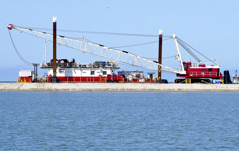
In layman’s terms, island restoration, according to the CPRA Master Plan, is pumping sand onto the shoreface and dune, adding lighter sediment to the backside for the development of marsh and planting vegetation on the dune areas. But just as the naturally formed islands are broken up by waves and moved by currents, so too will the restored islands.
The general scarcity of sand-sized sediment on the shelf means that few heavy particles will naturally find their way to the island to replenish it, so it’s up to humans to transport sand from seabed deposits and replenish the island’s sand. It seems that the long-term existence of many of the barrier islands will be dependent on frequent restoration projects; the 1999 Trinity Island project had a projected lifetime of 20 years.
The Mississippi River has emptied into seven delta complexes over the past 6,000 years, and each delta left barrier islands behind. Many are now underwater shoals of sand deposits. Our best-known island, Grand Isle, is from the same time period as the Timbalier Islands and the Dernieres Islands, of which Whiskey Island and Trinity Island remain. These islands were formed from the Lafourche Delta between 1,000 and 3,000 years ago. Grand Isle attributes its status as the only inhabited and vacation island in Louisiana to its greater geologic stability.
My favorite barrier islands, the Chandeleurs, are older than Grand Isle and its contemporaries by as much as 1,000 years. The Chandeleurs were formed during the St. Bernard delta period 2,800 to 4,000 years ago. While most of the major islands west of the Mississippi River have received restoration treatment, the elderly and ecologically rich Chandeleurs have not been given any restoration. The main island was breaking up badly until the 2010 BP oil spill, when crews quickly pumped sand from a nearby underwater deposit onto the shore face in an emergency effort to stop the oil from completely covering the island. Consequently, the main Chandeleur Island is looking solid; vegetation is flourishing, and the skies are full of birds. I can only imagine how beautiful the islands would become with an engineered restoration project.
Why save barrier islands?
So why should we try to save these islands, which are in constant decline? The sand that we pump onto the islands only lasts a millisecond by geological time, and we will need to repeat this task over and over.
We are forced to do this because we occupy the soft and vulnerable land deposited in 6,000 years of abandoned river deltas. The heavy sand structures of the barrier islands break the wave energy from the Gulf and reduce the erosion of the land on which we built.
In the previous 5,900 years, the creatures of the Mississippi River deltas lived fluid lives adopted to a coastline in motion, but we are proficient at rigid structures, and so we did something unprecedented in history: confined the nation’s largest river. That let us build more rigid structures in the delta, which we now have to protect against the mightier forces of the Gulf, forever, no matter the cost. We must restore the islands, as many times as necessary, or create something functionally equivalent.
Even though the sand islands are not rigid in a structural sense and will always need restoration work, I would rather have them than rock jetties and seawalls. A restored barrier island is far more ecologically rich and better for our fisheries than seawalls and jetties. Plus, over time, the rigid structures will also break up, sink and fall over because of the soft sediment. If you have ever hit submerged rocks, pipes, pilings or any of the other trash in our estuary, you will agree with me that, in comparison, hitting a sand bar is better.
Pumping sand
Fortunately, pumping sand is cheaper than you might think. In the 2017 CPRA Coastal Master Plan, $1.5 billion is allocated for barrier island restoration. That may seem like a lot of money, but barrier island restoration is just 3% of the total budget. Marsh creation through sediment dredging and placement is $17.8 billion, or 36% of the budget. Individual island restoration projects vary in cost, such as the $10.8 million spent on the first Trinity Island restoration in 1999, to $103 million spent on the recent 2018 Whiskey Island restoration project.
Island restoration is dependent on access to particular types of sediment, including sand and mixed sediment. The Louisiana Sand Resource Database (LASARD) records locations of usable sediment. Also, about 50% of the dredged sediment from the lower Mississippi River can be used for island restoration, and the CPRA and the U.S. Army Corp of Engineers are considering how this continuing sediment resource can be used most effectively.
The commitment by Louisiana and the CPRA to continue barrier island restoration projects is excellent news for the protection of the coast and for inshore anglers. Hopefully, future generations will also have the chance to be inspired by the spectacular barrier islands of Louisiana.


